


Voting District 56861, Los Angeles County, California
About
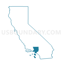
Outline

Summary
| Unique Area Identifier | 533106 |
| Name | Voting District 56861 |
| County | Los Angeles County |
| State | California |
| Area (square miles) | 2.07 |
| Land Area (square miles) | 2.07 |
| Water Area (square miles) | 0.00 |
| % of Land Area | 100.00 |
| % of Water Area | 0.00 |
| Latitude of the Internal Point | 34.75563560 |
| Longtitude of the Internal Point | -118.05920570 |
Maps


Graphs
Select a template below for downloading or customizing gragh for Voting District 56861, Los Angeles County, California


Neighbors
Neighoring Voting District (by Name) Neighboring Voting District on the Map
- Voting District 56495, Los Angeles County, CA
- Voting District 56627, Los Angeles County, CA
- Voting District 56639, Los Angeles County, CA
- Voting District 56645, Los Angeles County, CA
Top 10 Neighboring County Subdivision (by Population) Neighboring County Subdivision on the Map
Top 10 Neighboring Elementary School District (by Population) Neighboring Elementary School District on the Map
- Lancaster Elementary School District, CA (112,669)
- Eastside Union Elementary School District, CA (24,221)
Top 10 Neighboring Secondary School District (by Population) Neighboring Secondary School District on the Map
Top 10 Neighboring State Legislative District Lower Chamber (by Population) Neighboring State Legislative District Lower Chamber on the Map
Top 10 Neighboring State Legislative District Upper Chamber (by Population) Neighboring State Legislative District Upper Chamber on the Map
Top 10 Neighboring 111th Congressional District (by Population) Neighboring 111th Congressional District on the Map
Top 10 Neighboring Census Tract (by Population) Neighboring Census Tract on the Map
- Census Tract 9003, Los Angeles County, CA (4,514)
- Census Tract 9002.01, Los Angeles County, CA (1,261)